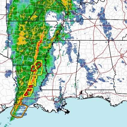
Hale and Perry Counties could see severe weather, including straight line winds in the 55-60 mile per hour range, as a powerful storm system moves across Alabama on Wednesday afternoon and evening.
The National Weather Service says the storm system will begin to reach the state’s western border at around 5:00 this evening, and will be in the Western Black Belt by 8:00 p.m.
Jason Holmes, a meteorologist with the National Weather Service’s Birmingham office told the Herald on Wednesday afternoon that the storm system could become more unpredictable as it picks up strength on its way into the state.
“It’s a very dynamic storm system,” said Holmes, who was watching the storm’s effects on Mississippi as he was being interviewed. He said Jackson, Miss. was experiencing winds in the 50-60 mile per hour range as of the time this article was published.
NWS released maps ahead of the storm placing Hale and Perry Counties, along with the rest of the western Black Belt, in an area of “moderate” risk for tornadoes, thunderstorms, and damaging winds that could reach 80 miles per hour.
Holmes said the strongest gusts will likely be unpredictable and result from a number of variables that will develop as the storm progresses. While not all parts of the state would experience such intense winds, Holmes said, it was important to stay weather aware and prepared in the event your area does.
He pointed out that winds in Jackson, just west of the Black Belt, were already approaching 60 mph.
“With winds that are already moving at that speed, if you factor in storms, sometimes you can get acceleration,” Holmes said.
The storm, which is moving fast, also brings with it a potential for “brief but potentially powerful” tornadoes, Holmes said.
In any event, the main concern for public safety will be downed trees and power lines creating road hazards and power outages. Holmes said it was important for people to have multiple reliable ways of checking the weather as a storm line this approaches.
“It’s unpredictable,” he said.
